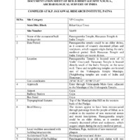
Documentation Sheet of Built Heritage/Site N.M.M.A., Archaeological Survey of India for Pancaganesha Mandir, Hanuman Temple, Indra Temple, Donative shrine
Item
-
Title
-
Documentation Sheet of Built Heritage/Site N.M.M.A., Archaeological Survey of India for Pancaganesha Mandir, Hanuman Temple, Indra Temple, Donative shrine
-
Subject
-
Hindu temples--India
-
Geographic coordinates (latitude, longitude)
-
24° 46' 38.42", 85° 0' 23.45"
-
Brief history
-
Unknown
-
Local tradition
-
Darshan
-
Location
-
Pancaganesha Mandir is west of 16 padas. Hanuman and neighboring temples are located northeast of the Main Temple and north of 16 padas
-
Topographical features
-
Top of the Mundaprishta hill on the western bank of the Phalgu, across from the Sita Kunda
-
Usage
-
Active worship and darshan
-
Structure
-
Panchaganesha is an old rock shrine with two well-sculpted pillars. It is an old structure which has been tiled and gated. Other three shrines seem to be newer additions to the temple which were constructed to house images.
-
Approachs
-
Through Chand Chaura or north from Brahmasaror
-
Airport
-
Gaya
-
Building materials
-
Stone
-
brick
-
tiles
-
Railway station
-
Gaya
-
Bus stand
-
Gaya
-
Conservation assessment
-
Good
-
Ownership
-
Vishnupada Prabandhakarini Samiti Ilake Chaudahasaiya Gayapala; current head of committee is Shankaralala Pathak (Ghadiwala)
-
Present condition
-
Maintained
-
Omeka identifier
-
sci-site09-KPJRForm.pdf
-
Site number
-
site09
-
Abstract
-
Neighboring shrine is a mish-mash of numerous sculptures plastered in the walls
-
Protection status
-
Well protected
 sci-site09-KPJRForm.pdf