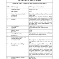
Documentation Sheet of Built Heritage/Site N.M.M.A., Archaeological Survey of India for Back Alley and Eastern Turn to River toward the ghat
Item
-
Title
-
Documentation Sheet of Built Heritage/Site N.M.M.A., Archaeological Survey of India for Back Alley and Eastern Turn to River toward the ghat
-
Subject
-
Hindu temples--India
-
Geographic coordinates (latitude, longitude)
-
24°46'39.24", 85°00'34.20"
-
Location
-
Path from northern entrance to Vishnupad back alley to the river between Adi Gadadhara temple and Uttaradi math
-
Topographical features
-
On the eastern slope of the Mundaprshta hill
-
Usage
-
Active worship
-
Structure
-
1. northern entrance -l several images are plastered in the western wall, two were grilled
2. two are on the eastern wall
3. several were in a niche cum small 5’ shrine
4. Shiva linga and a small fragment in a small chamber on southern wall
5. two panels stuck in a water tank and two more were stuck in the wall on the way to the ghat
6. three images at exit to Gadadhara ghat
-
Approachs
-
from Vishnupad to the Gadadhara ghat
-
Airport
-
Gaya
-
Building materials
-
Brick
-
stone
-
Railway station
-
Gaya
-
Bus stand
-
Gaya
-
Ownership
-
Vishnupada Prabandhakarini Samiti Ilake Chaudahasaiya Gayapala; current head of committee is Shankaralala Pathak (Ghadiwala)
-
Present condition
-
Decent
-
Omeka identifier
-
sci-site21-KPJRForm.pdf
-
Site number
-
site21
-
Abstract
-
A thoroughfare from Vishnupad northern entrance to ghat
-
Protection status
-
Not all are well protected
 sci-site21-KPJRForm.pdf